Just added a number of new images to the OSM images for mapping – here a few examples:
First is a Sentinel-2 image of the Central Alps in late September last year. This area is fully covered in high resolution images from other sources but many of them are at least partly not well suited for mapping due to snow or clouds. This image should be useful to update glacier extents in the area. There are also several other images of particular use for glacier mapping like the African glaciers which i featured here recently.
And there is an image of the Kerch Strait between the Sea of Azov and the Black Sea with the new bridge under construction there:
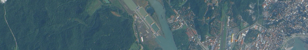
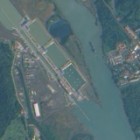
The newest image is of the Pacific side of the Panama Canal – an area which was cloud covered in the older Panama Canal image. This image was taken by the EO-1 satellite just a few days back.
The image was also taken at fairly low tidal water levels so the tidal flats at the coast are well visible.