The OSM images for mapping now contain two new images that can be used for remote mapping in OpenStreetMap:
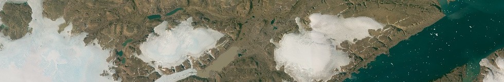
The Greenland mosaic
The recently introduced Greenland mosaic should offer a much more up-to-date source for mapping in Greenland than existing image sources with more accurate and better readable data. Offering this in Mercator projection is far from ideal but the only way this can be used as a source in current OSM editors.
Since the image overlaps existing images in the OSM images for mapping you can specifically select the individual layers if you need to.
tms:http://imagico.de/map/osmim_tiles.php?layer=ls_polar&z={zoom}&x={x}&y={-y}
will provide tiles from the older northern Greenland off-nadir images with priority over the new image data. Without the layer parameter you will get the Greenland mosaic.
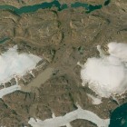
Here two comparisons with the imagery currently available from Bing and Mapbox:


Northwest German coast tidal flats
The second new image is from the tidal flats at the northwest German coast. These change in shape quite rapidly due to the tidal currents eroding and depositing material at different places. The images now added show the area at low tide and are available both in visual color and in false color infrared. They can be used to improve mapping of tidal flats, shoals and salt marshes in the area.


The visual color imagery can be accessed with:
tms:http://imagico.de/map/osmim_tiles.php?layer=LC81960222015233LGN00vis&z={zoom}&x={x}&y={-y}
the infrared version with:
tms:http://imagico.de/map/osmim_tiles.php?layer=LC81960222015233LGN00ir&z={zoom}&x={x}&y={-y}
Final note: Please keep in mind use of this service is only allowed for mapping in OpenStreetMap. If you would like to use the images for some other purpose visit the geodata page on services.imagico.de and contact me for individual terms.
Update: For integrating the images in JOSM you can also enter http://www.imagico.de/map/osmim-imagicode.xml as additional image layer source in the preferences (imagery.layers.sites).