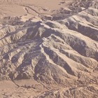
When NASA after the SRTM (shuttle radar topography mission) in 2000 released the first SRTM data (the latest version of which i reviewed previously) this was for large parts of the wold the first detailed relief information available at all and for even larger parts the first relief data that was accessible at reasonable costs and with a uniform quality standard. There probably is no other single data set that was of such fundamental influence for today’s geodata landscape as SRTM.
Today, 15 years later, SRTM is still in some part of the world the best freely available relief data source but there is an increasing number of other open elevation data products as well. Most of them locally produced data covering only smaller areas, there are still very few free data sets with a more or less global scope. The newest one is the ALOS AW3D30 Global Digital Surface Model from the Japanese space agency JAXA. I now wrote a detailed review of this data set.

