
When i wrote about the rendering of human settlement areas based on OpenStreetMap data i provided a small sample data set covering central Europe to demonstrate the technique. I have now streamlined the data processing involved and generated those settlement polygons for the whole planet.

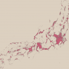
You can find this data for download and use in your own maps (under CC license). Generalization is done for use at zoom levels 8-10. Here a few magnified areas from various areas:


I also put up two tools that are used in the processing on github:
- osm_tile which splits an OSM file into an arbitrary number of smaller files defined by bounding boxes while running through the file only once.
- gdal_nodedensity is a general purpose node/way density plotter for OSM data – kind of a combination of gdal_rasterize and Osmium nodedensity into a single tool.
Custom settlement data processings and use of this data outside the restrictions of the CC license is available on the Imagico.de services and products.
Finally a rendering example from the northwestern United States (Washington – Oregon):
