After producing the Franz Josef Land map and the Severnaya Zemlya map i have now completed another similar map of the third large group of islands in the Russian Arctic: Novaya Zemlya.

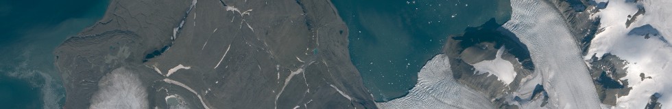
Novaya Zemlya is located south of Franz Josef Land and north of the Ural mountains at the eastern edge of Europe. It is best known as the main former nuclear test site of the Soviet Union. It consists of two large islands, Severny and Yuzhny Island which are separated by a narrow fjord, the Matochkin Strait. The northern island contains the largest glacier of Europe, the Severny Island ice cap.

Novaya Zemlya was the first island in the high Arctic to be discovered by explorers from western Europe. Willem Barents first landed there 1595. The islands separate the Barents Sea from the Kara Sea with a relatively sharp contrast: while the west coast is largely ice free even for most of the winter ice often persists at the east coast quite late into the summer.

The map employs the dot pattern rendering i introduced some time ago on a larger scale and generally improves on the mapping and map rendering techniques.
The satellite image mosaic is almost fully generated from Landsat 8 data from the last three years.

You can browse the map on maps.imagico.de and find the map data and imagery for licensing on services.imagico.de.