I wrote about the problem of positional accuracy of satellite images before on several occasions. Working with images from the Arctic for the update of the Franz Josef Land map again i realized a few things i wanted to share here.
The common assumption with high resolution open data images is that positional accuracy is usually fine but not great. But the errors as specified by the image producers are usually 90 percent limits and therefore not really that meaningful. This is a complicated matter in general and there are a lot of different sources of errors that play in here. The satellite image producers (in this case the USGS and ESA) are working on improving the positional accuracy of their images but the focus is mostly on reducing the relative errors between different images of the same area (allowing for better processing of time series) and not so much on the absolute accuracy.
The most widely neglected aspect of positional accuracy is the quality of the relief data used for terrain correction. The reasoning is typically that
- a certain elevation data error generally translates into a significantly smaller error in image position for small field of view nadir looking satellites like Landsat or Sentinel-2.
- the most relevant parts of the earth surface, i.e. densely populated urban areas, are in flat regions where relief data errors are not a big practical problem.
- as long as relief data without big errors is available for about 90 percent of the earth land surface the rest does not really cause problems with the error statistics.
But if you work in parts of the world outside these 90 percent you can find some pretty noticeable errors. Sentinel-2 is in particular a good study case for this because (a) due to the relatively wide field of view it is fairly sensitive here and (b) it is known that ESA uses relief data from viewfinderpanoramas.org for high latitudes which can be studied and analyzed directly.
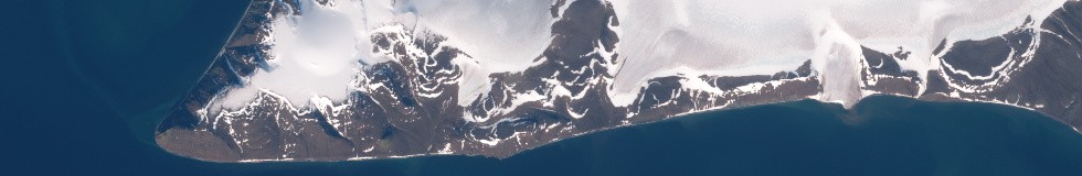
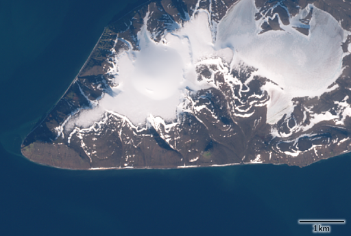
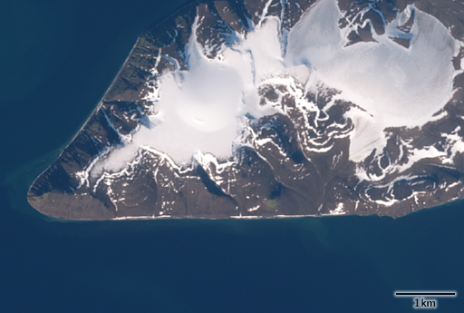
Normally the largest errors occur in mountain areas but the errors that are best to measure and analyze are those at the coast which occur when the relief data has a horizontal offset and the coast features elevation values significantly above sea level. Here two examples of fairly impressive relative differences of the coast position in image pairs, both in the order of 100m, in Sentinel-2 images. The first is from Bell Island in Franz Josef Land:
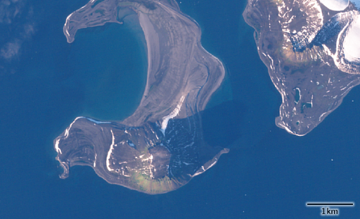
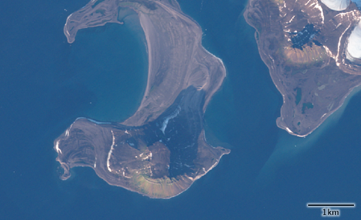
The second example is from Bennett Island in the De Long islands:
This second example is also telling because it indicates ESA is using an older version of the relief data not containing the more recent update which replaces the offset and low accuracy data for the De Long islands with more precise data i introduced here:
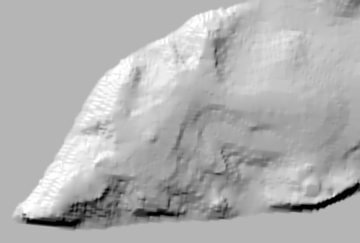
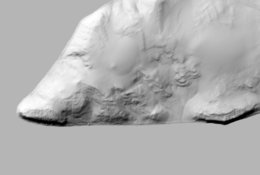
You can see that the northwest coast is correct and does not change between the different images because it is at sea level even in the offset relief data used while the south coast is wrong because of the non-zero elevation in the old relief data there (shown on the left in the second comparison).
The Bell Island image pair by the way is from four days apart in September 2016, the Bennett Island images are from the same day (August 25 this year) from Sentinel-2A and Sentinel-2B.