
When i announced the Green Marble mosaic version 2 mosaic recently i mentioned that the land coloring is based on MODIS data while the water color is created from Sentinel-3 data. There are multiple reasons for this choice of data sources and one of them is that only very few of the earth observation satellites currently operating actually record the whole planet surface. I discussed recording limits of individual satellites in the past and here i want to take a more systematic look at the matter.
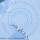
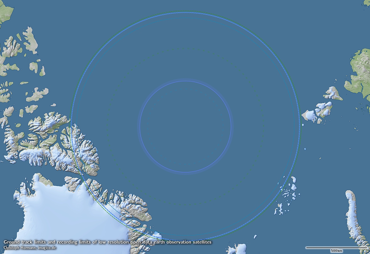
As i have mentioned on several occasions most earth observation satellites record their images from a sun synchronous orbit meaning that the orbital plane of the satellite rotates against the earth rotation and thereby the orientation of the orbit towards the sun and therefore the lighting condition as it flies along its path stays constant from orbit to orbit. To achieve this the satellite has to be at a specific orbital inclination depending on its altitude. Since the range of orbital altitudes of earth observations is quite narrow their orbital inclinations are also similar. The orbital inclination also defines on how far north an south the satellite flies. When i plot the latitude limit of the ground track of the satellite’s orbit i get the following for the most commonly used open data earth observation satellites.
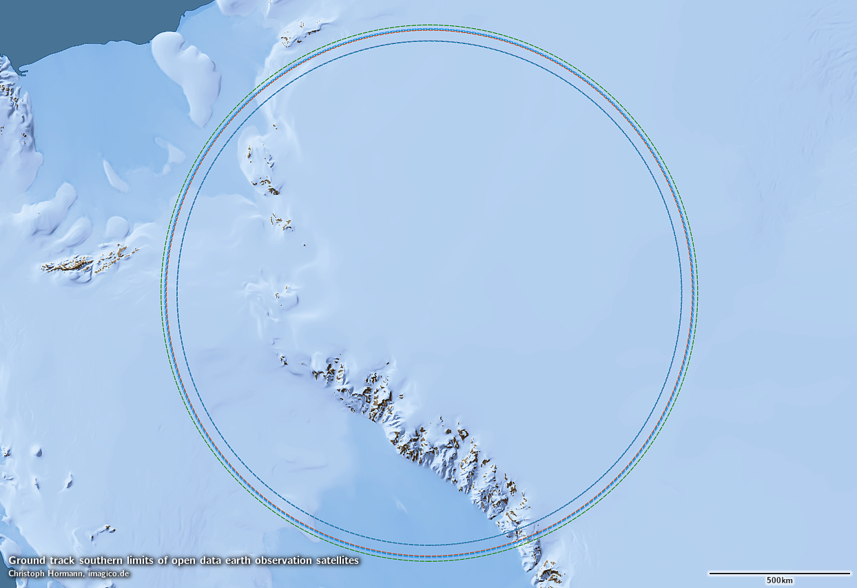
Southern ground track limits of open data earth observation satellites
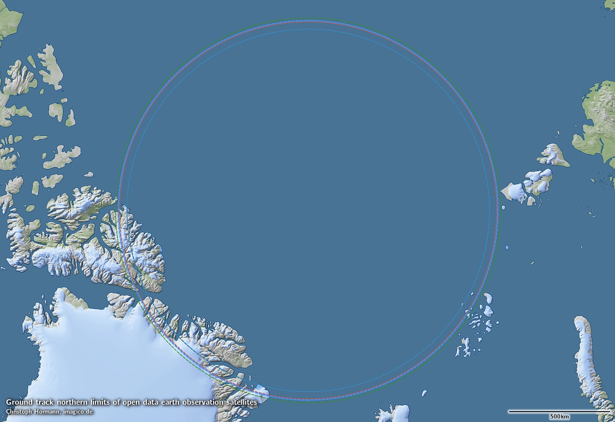
Northern ground track limits of open data earth observation satellites
The satellites with the VIIRS instrument (Suomi NPP and NOAA-20) have the highest orbit with about 834km which leads to the lowest latitude limit. The satellites with the lowest orbits are Landsat and the MODIS satellites (Terra and Aqua) at an altitude of slightly more than 700km.
The actual recording limit of the satellites is defined by this ground track limit plus half the width of the recording swath of the satellite. This leads to – as illustrated in the following – Sentinel-2 recording slightly further north and south than Landsat despite a higher orbital altitude. But for Landsat we also have the practice of off-nadir recordings made by having the satellite look slightly sideways. The limit of these recordings as they are routinely being made is indicated by the dotted line.
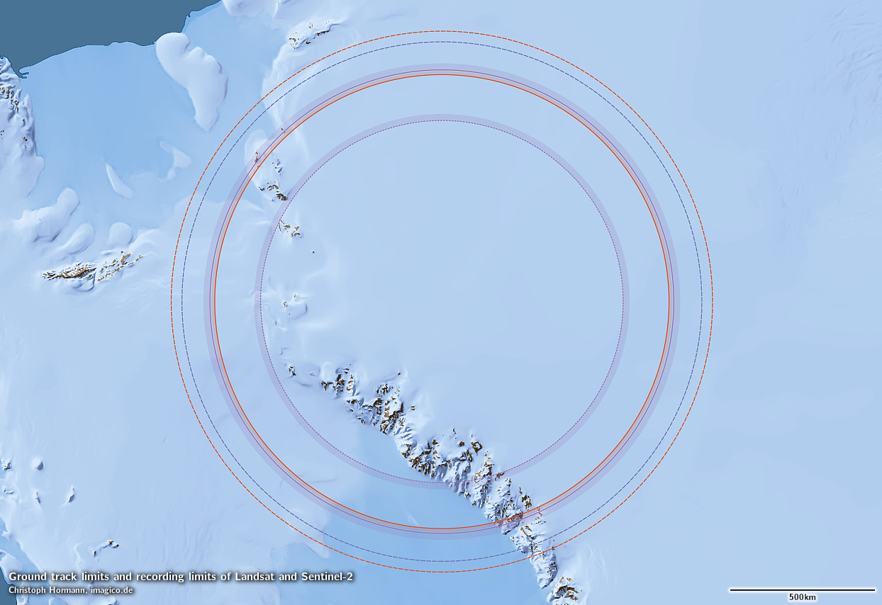
Southern ground track and recording limits of Sentinel-2 (red) and Landsat (violet) including off-nadir recordings (dotted)
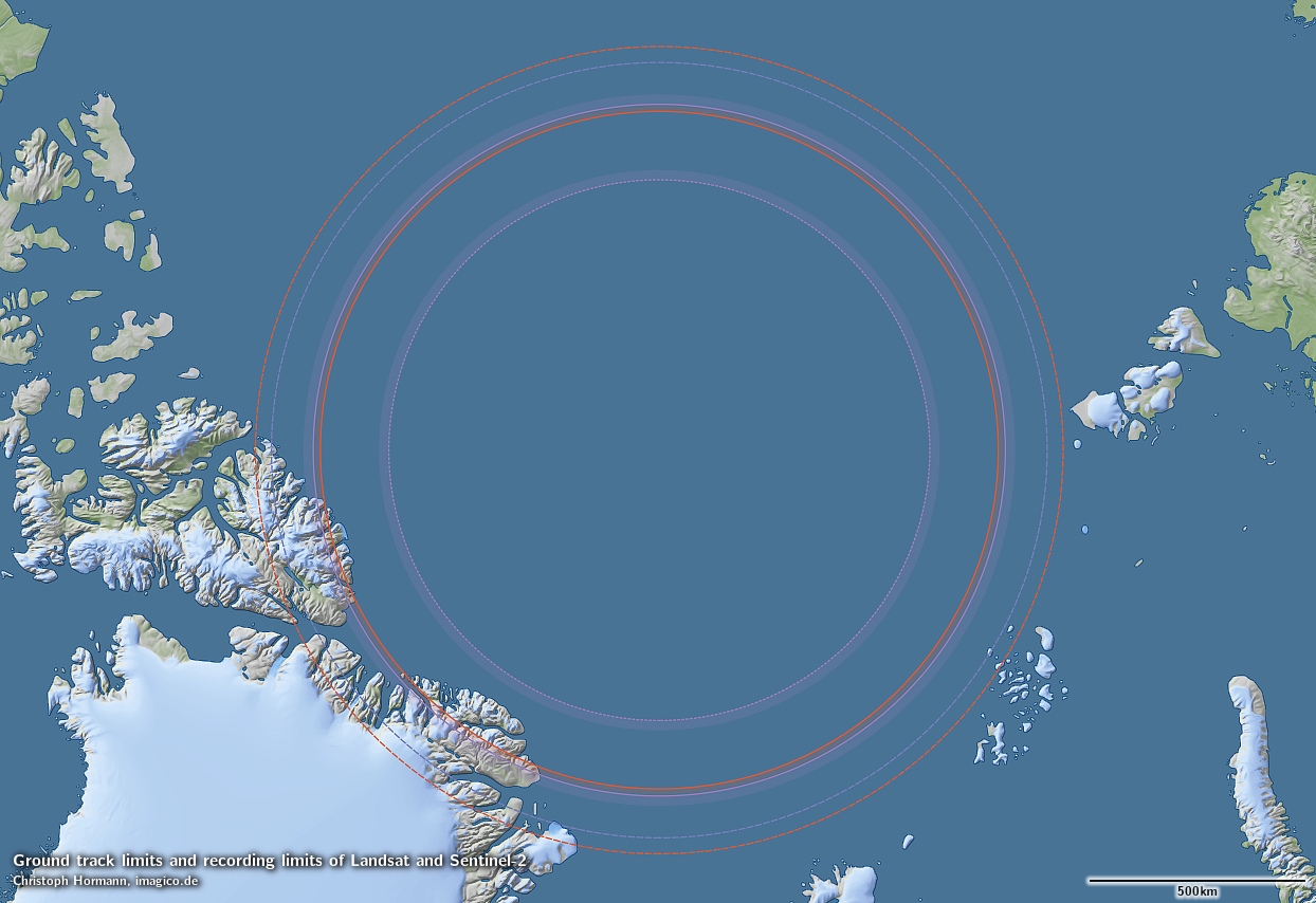
Northern ground track and recording limits of Sentinel-2 (red) and Landsat (violet) including off-nadir recordings (dotted)
The situation becomes a bit more complicated with the lower resolution instruments. Both Sentinel-3 optical instruments record asymmetric views and therefore have different recording limits in the north and south – in the north their view reaches up to the pole meaning there is no recording limit while in the south you have the limits shown in the following illustration in blue. Further south is the limit of the GCOM-C SGLI intrument which has a symmetric view and therefore equal limits north and south.
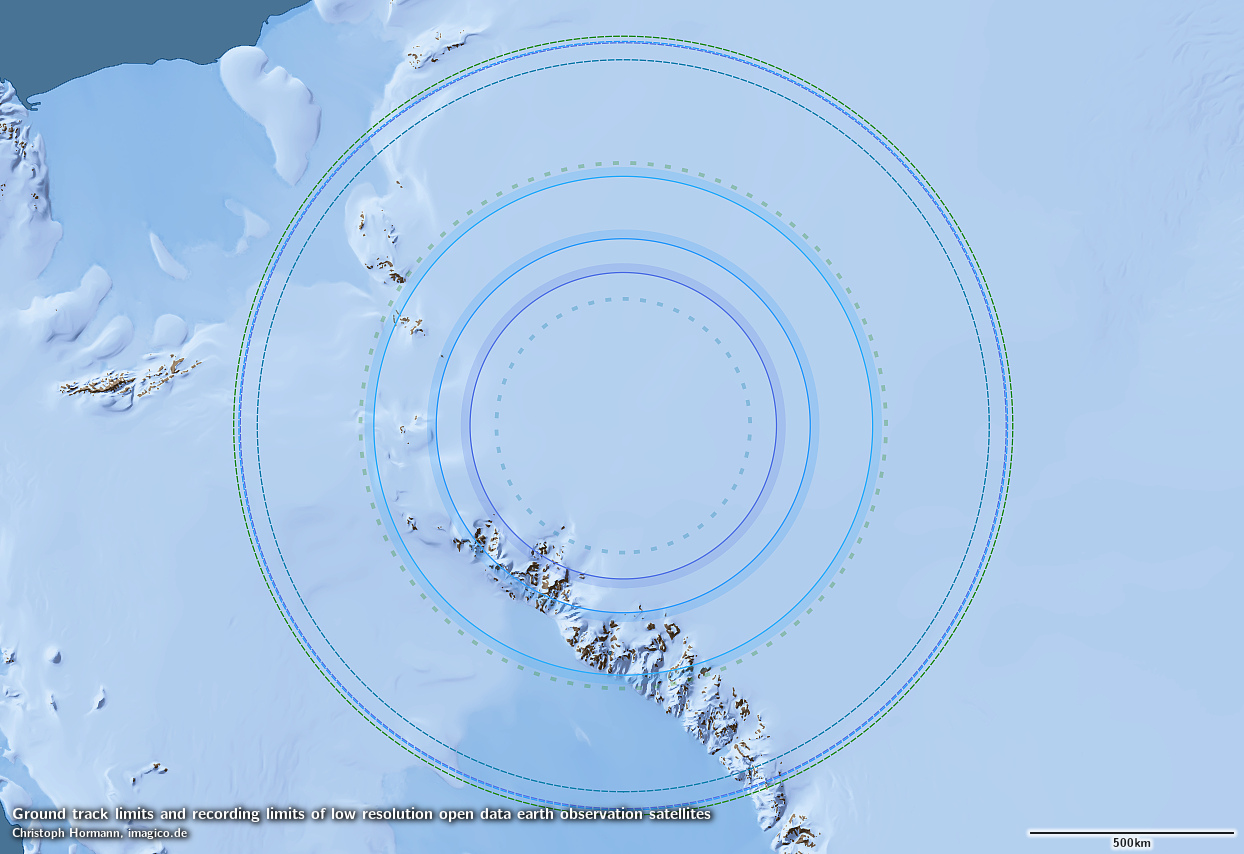
Southern ground track and recording limits of Sentinel-3 (blue) and GCOM-C SGLI (violet) as well as pole overlaps of MODIS (dashed cyan) and VIIRS (dashed green)
Northern ground track and recording limits of GCOM-C SGLI (violet) as well as pole overlaps of MODIS (dashed cyan) and VIIRS (dashed green)
No limits in either north or south are shown for MODIS and VIIRS – these both reach beyond the pole on both sides. These are the only data sources available that currently offer a truly global coverage of the whole earth surface in the visible spectrum. What i show in the illustrations with a dashed line is the limit of overlap across the pole – within these circles twice as many images are recorded therefore.
What has to be kept in mind is that the satellite orbits as discussed in the beginning are all very similar and the different recording limits primarily result from the different recording swath widths. And the wider view satellites differ in resolution over their area of view quite significantly because at the edges the earth surface is much further away than in the center of the view. Hence even though the poles are recorded by some of the satellites the resolution of these recordings is not as good as it is at lower latitudes where the best available image is always much closer to a ground track of the satellite.