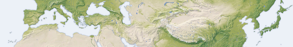
As a byproduct of producing the Green Marble mosaic a global vegetation data set was generated as well. I now processed this further for use in maps and also designed a new map style focussed on vegetation for showing this:

Like the Green Marble color image this covers the whole planet – including Antarctica which is missing in most other vegetation data sets. This is of course mostly symbolic, vegetation in Antarctica is so sparse it is hardly detectable at this scale. Here a view of the only part of the continent with notable vegetation, the tip of the Antarctic peninsula and surrounding islands.

An important processing step for using vegetation data in map rendering is masking and filling of water surfaces from the surrounding land data. Water generally turns up with no or very little vegetation in the data. For use in maps, especially in combination with generalized waterbody data, you want these areas to be represented with the same amount of vegetation as the land around.
Here a zoomable map based on this data set.
If you are interested in using this in your own maps visit the Green Marble vegetation map page on services.imagico.de.